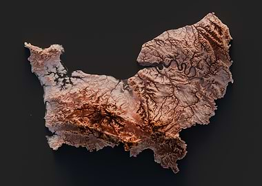
This is a 3D topographic map of The Normandy region in France, rendered in a realistic style. The map is presented in a light brown color, with darker brown hues highlighting the mountainous regions. The intricate network of rivers and streams is clearly visible, winding through the landscape. The map is set against a dark gray background, providing a stark contrast and emphasizing the details of the terrain.
Select product type
Choose size
Add frame

Legal Disclaimer
This Displate was created by an independent artist. It may feature trademarks, designs, copyright-protected works, images of public figures or other rights. Unless expressly stated otherwise, the respective rights owners have not consented to the offer and sale of the Displate.
Gloss
Shine on with vivid colors
With their gently reflective surface, glossy Displates offer enhanced contrast, highlighting vibrant hues, deep blacks, and intricate details.
Go for gloss if you're looking for a photo-like finish. For best effect, try to avoid direct light when arranging your posters.
Matte
Sleek, soft, and elegant
The subtle matte finish draws more attention to the smooth metal surface of your Displates, absorbing light and enhancing their elegant, soft texture.
The colors are slightly toned down, making this finish a perfect fit for all atmospheric illustrations and paintings.
Explore more posters
Displates in your awesome spaces
See all inspirationsDiscover exclusive posters
from top brands

Join our newsletter for the latest discounts and Displate goodies
By clicking “Sign up”, you agree to receiving emails and to processing of your personal data in accordance with the Privacy policy. The data will be processed to customize the newsletter content according to your personal preferences. The controller of your personal data is Displate, i.e. GWD Concept Sp. z o. o. with a registered office in Warsaw. You can unsubscribe at any time by clicking the “Unsubscribe” button in the email footer, unchecking your consent in the “Basic Info” tab of the customer panel, or sending a request to support@displate.com.


